

Introduction |
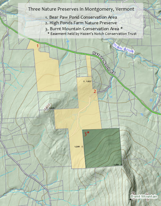
The High Ponds Farm in the Hazen's Notch area of Montgomery, Vermont is a privately owned nature preserve that is open to the public on a limited basis. The 232-acre property was initially purchased by the Anderson family in 1995. The adjoining 160-acre Burnt Mountain parcel was also purchased by the Anderson family in 1996.
>> A recent video created by the Hazen's Notch Conservation Trust and posted to their Facebook page and Instagram account is meant to portray the Burnt Mountain Conservation Area. The video may give viewers the impression that the High Ponds Farm has been conserved. It has not. The video may also give viewers the impression that the Burnt Mountain Conservation Area and The High Ponds Farm are all one property. They are not. <<
High Ponds Farm + Burnt Mountain Area Map 2024
Burnt Mountain Conservation Area Description, Birds, Plants, Mammals, Recreation, Conservation Value, Stewardship, Visitor Information, Property + Trails Map, References
Detailed information about the trails of the High Ponds Farm including the trail to the Moosewood Ponds, trail to the High Meadow, and trail to the summit of Burnt Mountain can be found on the website of the Hazen's Notch Association:
Burnt Mountain, Montgomery, Vermont
The Anderson family set out to preserve a beautiful, former hill farm that supports important natural communities and associated species. Their goal is to maintain an ecologically functional landscape through responsible stewardship, which is intended to preserve plant communities and a diversity of habitats. Once an active subsistence farm, beavers have since built numerous ponds. The Moosewood Ponds support fish, amphibians, reptiles, invertebrates, native plants and terrestrial species such as otter, mink, weasel, deer and moose. The High Meadow is managed as a native wildflower meadow for pollinators with tall grass/shrub habitat for ground nesting song birds.
Professional foresters and ecologists have made detailed inventories and assessments of the flora and fauna present. Numerous areas with rich forest soils and mature trees provide ideal conditions for woodland plants.
The Stewardship Management Plan emphasizes biological diversity and forest health, protection of soils, wetlands, and riparian areas, protection of habitat for interior forest birds and mammals, protecting corridor connectivity with adjacent conservation lands, preservation of historic cultural resources, and maintenance of two small orchards and a young forest / old field / shrub habitat to support songbirds and pollinators.
Education and Recreation: Since purchasing the property, the Anderson Family has welcomed thousands of visitors to the High Ponds Farm. Students from 40 towns in northern Vermont have come for natural science field trips organized by the Hazen's Notch Association. The HNA Summer Camp has visited every year to learn about wetlands and forest ecology and to explore the numerous trails. The public has enjoyed visiting the Moosewood Ponds and the High Meadow to enjoy the spectacular views of the surrounding mountains.
Visitor Information |
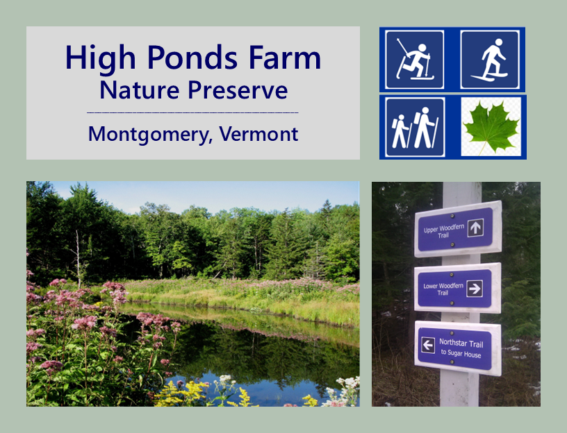
A network of trails provides opportunities for walking, hiking and nature observation in Spring, Summer and Fall. In winter, trails are closed to hiking but are open to cross-country skiing and snowshoeing. Please observe all signs posted at the entrance to the property and within the property. In Winter trail access is from the HNA Welcome Center at 1423 Hazen's Notch Road.
Fishing, Swimming, Fires, Camping, Motorized Vehicles & Bicycles are not allowed. Please do not collect plant material. Dogs must be on leash at all times but are not allowed in Winter. Trails are closed to everyone during Spring mud season, from April 1 to May 21. Hikers should limit their outings to walking local roads during Autumn hunting season and during Spring mud season. The entire area closes at sunset.

The old town road through the property was discontinued by the Town of Montgomery at a meeting of the Selectboard in February 2004. The road is now a private road. Motor vehicles are no longer allowed within the property. Visitors should park along the edge of the Rossier Road such that they do not block vehicular access for the owners. Do not park close to the gate. There is no parking and no access to trails from December 1 to May 21.
Please respect this private property and help to ensure continued access.
Hazen's Notch Trails Map 2024
High Ponds Farm + Burnt Mountain Area Map 2024
High Ponds Farm and Burnt Mountain Area Suggested Routes 2024.jpg

For complete visitor information, see the website of the Hazen's Notch Association: www.hazensnotch.org
Natural History1 |
A confluence of natural and cultural histories has shaped these lands over many years. The geological events that formed the northern Green Mountains have given the landscape its basic underlying shape over millions of years. Glacial history of several thousand years ago further refined this underlying bedrock and added streams, ponds and wetlands; and hills, valleys and steep mountain slopes to the diversity of the landscape. In the past few hundred years, human activities on these lands have added more features to the landscape as its inhabitants gleaned a subsistence life here from the existing natural resources.
By hiking on the trails at the High Ponds Farm, many natural elements from these historical events may be seen and enjoyed. Much can be learned by the careful observer about the lives of the plants and animals that presently live here. The diversity of habitat types at the High Ponds Farm is great and can be organized under one or more of three broad groups.
The dominant habitat in this part of Vermont is the northern-hardwood forest formation. Several types of forest that occur within this formation are here and include the following tree species: sugar maple, red maple, yellow birch, American beech, white ash, butternut, American basswood, American elm and aspen species. Pockets of northern evergreen forest, notably along Flood Brook, include eastern hemlock, balsam fir, red spruce and white spruce. Other important species commonly associated with the spruce-fir forest type in the Northeast, such as eastern white pine and northern white-cedar, are present. As one goes up in elevation, conifers including red spruce and balsam fir become more evident culminating in a compact area of montane spruce/fir forest at the top of Burnt Mountain. The forest matrix is very long-lasting and produces a stable environment.
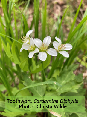
Many Spring wildflowers bloom well before the forest canopy has grown. Spring beauty, Dutchman's breeches, squirrel corn, red trillium and trout lily carpet the forest floor with bright green leaves and exquisite flowers. As the shade of expanding tree leaves increases, summer woodland wildflowers grow at a slower pace and benefit from the cool, shady conditions. Goldthread, Canada mayflower, partridgeberry and wood sorrel form large clonal masses.
The birds and animals that live in these forests fill every available micro-habitat. Many bird species live at the ground level - Ruffed Grouse, Ovenbird, and Hermit Thrush. Others make use of trees for nesting, perching and feeding - Scarlet Tanager, Rose-breasted Grosbeak and several warblers, including Black-throated Blue Warbler and Redstart. Yellow-bellied Sapsucker, Downy Woodpecker, Black-capped Chickadee and White-breasted Nuthatch excavate cavities in trees for nesting.
The forests at the High Ponds Farm provide food and cover for large and small mammals alike. The density of trees conceals the presence of some of Vermont's largest animals - moose, white-tailed deer, and black bear. Every surface is habitat for small mammals from red squirrels in the canopy to woodland jumping mice in a rotting log.
Within the context of a forested landscape, meadows represent an important and very different habitat. Abundant sunshine and warmer air temperatures contrast with the surrounding forests. The dominant plant types are shrubs, wildflowers, ferns and grasses/sedges. An orchard is a modification to the landscape maintained by human activities and may include many of the same plant types as a meadow. A well-tended planting of apple trees provides a season full of visual and essential delights from pink-white flowers visited by bees to delicious fruit enjoyed by people and wildlife.

The herbaceous perennials that make up a meadow die down to the ground each Fall. Unlike the forest, which keeps its structure after the leaves drop in the form of standing trunks with their branches and twigs, the meadow has full sunshine near the ground level for several weeks every Spring. The first flowers to bloom are understandably short in stature - wild strawberry, violet, and dandelion. Early ferns include interrupted and cinnamon ferns and New York fern. Grasses are dominant here and hold their delicate, colorful flower heads well above their lush growth of leaves. As Summer progresses, taller wildflowers add their color - orange paintbrush or hawkweed, ox-eye daisy, asters, goldenrods, Queen Anne's Lace, Joe-Pye weed, milkweed, and St. Johnswort.
Many species of birds make their nests in a meadow habitat. Song Sparrows build nests of grass directly on the ground protected from view by taller grasses and small shrubs. Chestnut-sided Warbler and Common Yellowthroat sing all summer long while they tend to their nests that are well disguised in taller vegetation. Eastern Bluebirds and Tree Swallows use natural cavities in dead snags or nest boxes placed out by people. At the edge between the meadow and the forest Least Flycatcher can be heard patrolling its territory; and Indigo Bunting calls loudly to lure any visitor or animal away from its nest location.
Insects are very numerous in a meadow. Butterflies top the list for colorful creatures as they feed from nectar flowers and lay eggs on a wide variety of plant species that will eventually feed the growing caterpillars of the next generation. Small mammals, such as meadow vole, find plenty of cover in the thick grasses which also provide an abundance of seed and stems for them to eat all year round. Wherever rock piles sit in sunshine, garter snakes find shelter, a food supply and extra warmth that allow them to live out their lives without the need to travel very far.
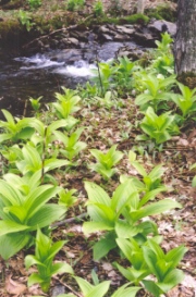
The substantial amount of rainfall that occurs in the mountains is carried downhill through a myriad of streams which begin as tiny rivulets in the higher elevations and gain in size until they reach and fill the great rivers in the lower valleys. Wetlands have a lot in common with meadows and the two share many of the same plants. Streams flow through forestland and retain a high water quality due to the shaded conditions and cooler temperatures there.
Many of the wetlands at the High Ponds Farm exist as a result of the work of beavers. They may be surrounded by forest or by meadow. Trees that have died because of the high water table weather to a light gray color and provide homes for cavity nesting birds, such as Yellow-bellied Sapsucker, and perches with a good view in all directions for flycatchers, such as Alder Flycatcher, and raptors, such as Broad-winged Hawk.
Large drifts of tall Joe-pye weed plants with large rose flower clusters and several species of goldenrod bloom in late Summer. Sedges and rushes crowd the edges of open water. Thick hummocks of interrupted, cinnamon and royal ferns give witness to the age of some of the wetlands.
In the muddy margins of the ponds, moose tracks and bear tracks are evidence of the presence of these beautiful animals as they come to the water's edge to drink. In the ponds themselves, several species of frogs and salamanders lay their eggs. Many dragonfly and damselfly species are present as they cruise the grassy edge of the water looking for mates, fending off challengers, feeding and occasionally perching on a warm stone.
The wetlands are fed continuously by the streams that flow through forest off the slopes of Burnt Mountain and Sugar and Rossier Hills. The water is cool and clear. Many creatures prefer the cool conditions. Brook trout fry feed on black fly larvae as northern dusky salamander lays its eggs under wet moss. Where hemlocks grow in ravines cut by hundreds of years of stream erosion, Winter Wren sings its long bubbly song.
As you hike the trails at the High Ponds Farm, you will traverse a wide diversity of habitat types that sometimes blend imperceptibly from one to the next. Enjoy the day knowing that many creatures are going about the seasonal cycles of life. With luck you may catch a glimpse of a moment in the life of a mammal, bird, amphibian, reptile or insect. The ferns, flowers, shrubs and trees are constant companions as they too undergo their life cycles. And the geology that supports the whole landscape may be seen in the tiniest grain of sand or the panoramic views from the top of a hill or mountain.
- Deborah Benjamin, September 18, 2009
Conservation Stewardship |
The Stewardship Management Plan emphasizes biological diversity and forest health, protection of soils, wetlands, and riparian areas, protection of habitat for interior forest birds and mammals, protecting corridor connectivity with adjacent conservation lands, preservation of historic cultural resources, and maintenance of two small orchards and a young forest, old field, shrub habitat to support songbirds and pollinators.
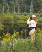
The wetlands restoration work at the Moosewood Ponds was intended to repair damage to these beaver ponds which took place Oct 1996. Project goals included restoration of habitat for beaver as well as numerous other animal and plant species supported by the ponds and the adjacent upland wet meadow and forest. Great care was taken to encourage regeneration of diverse native plants.
The area of the Moosewood Ponds was a cow pasture from the 1800's until 1948. The largest pond was likely created by beaver between 1948 and 1951. That pond appeared on the 1954 USGS topographic maps made from aerial photographs taken in 1951. Beavers made the other ponds in the 1970's.
Wetlands serve many purposes related to water quality. They slow water movement which helps to minimise soil erosion. By storing and filtering water, wetlands reduce flood risks, recharge groundwater, and maintain stable flows essential for both human and ecological resilience. Wetlands help to trap sediments, break down pollutants, and remove excess nutrients which also improves water quality.
The High Meadow is the original site of the Rodney Dodge and Mary Elizabeth Hayes Dodge Farm (1876 -1948). While the house and barn are no longer standing, the barn foundation and the cellar hole of the house and its foundation stones remain. White and Norway spruce, many Cortland apple trees and some "Reine des reinettes" apple trees were planted in 1954. Two successive owners allowed the High Meadow to become overgrown.
Project goals included restoration of numerous apple trees, two small sections of old field, establishing a native wildflower meadow for pollinators, and maintaining tall grass/shrub areas for song birds which prefer this habitat. Two areas of old field/shrub habitat merge into young forest adjacent to wetlands, creating a rich riparian buffer. Turkey and ruffed grouse nest and raise their young each year. Shrub and tree species include poplars, grey birch, white pine, chokecherry, willow, spirea, black spruce and tamarack. The stewardship activities at the High Meadow have habitat diversity as the primary goal.
The High Ponds Farm Nature Preserve lies within an area designated by the Vermont Department of Fish and Wildlife as a highest priority, interior forest block for conservation; including surface waters and riparian habitats of highest value and also of highest priority for conservation. The High Ponds Farm has strong natural resource values which support native plant communities, biodiversity, wildlife habitat, wildlife corridor, structural and functional connectivity, six beaver ponds, numerous woodland seeps, vernal pools, and several streams which form Flood Brook.
History of the Dodge Farm of Montgomery, Vermont2 |
Immediately after purchasing in 1995 the lower parcel of what would be called the High Ponds Farm
, the Anderson family asked Montgomery resident, historian and author Joe Sherman (author of The House at Shelburne Farms
, Fast Lane on a Dirt Road
and other books) to research the social, architectural and agricultural history of the property and the Hazen's Notch neighborhood. The information gathered and presented by Joe Sherman served to guide the Andersons as they set out to restore the property. James Tessman, the Franklin-Grand Isle County Forester, visited the property with the Andersons. We are grateful for his advice, support and strong encouragement.
# # #
In the late 1800s what is now the High Ponds Farm consisted of three subsistence farms: one at the end of the Rossier Road (John Green until 1890, then Peter Stone until 1900) which is now the access to the property; another centered around what are now the Moosewood Ponds (Elias Twist from Richford & Rosetta Stetson from Berkshire); and the third at the High Meadow (Rodney Dodge and Mary Elizabeth Hayes Dodge family).
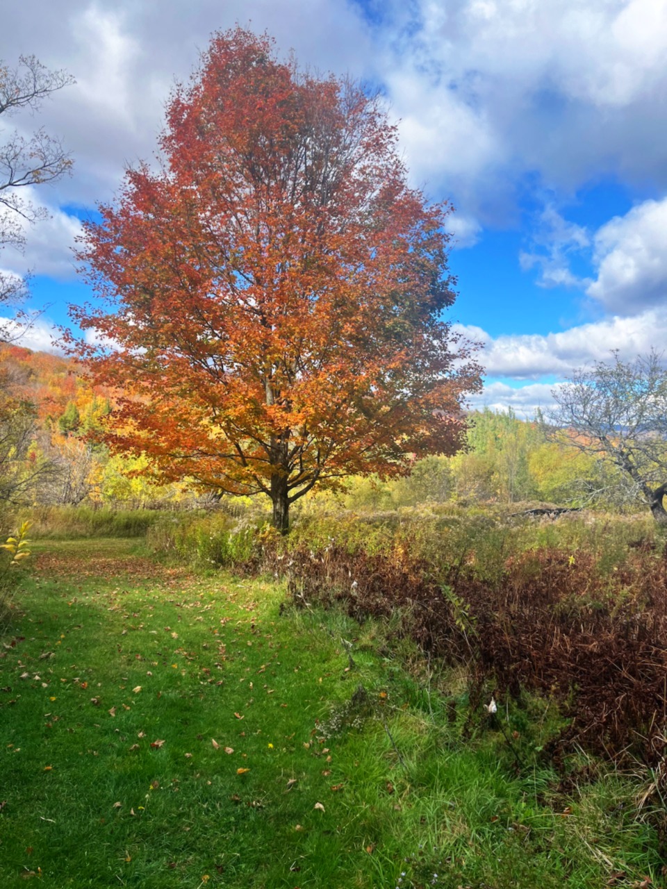
Mary Elizabeth Hayes Dodge (1848-1926) and Rodney Dodge (1845-1935) raised a large family at what is now called The High Meadow at the end of the Rossier Road in Montgomery, Vermont. John Rodney Dodge was born April 27, 1873 at the High Meadow. His siblings included Mary Elizabeth Dodge (1875-1944), Morton Dodge (1878-Deceased), Anna Norah Dodge (1880-1953), Mabel Margaret Dodge (1882-1964), Agnes Ellen Dodge (1885-1925), Rev Charles Augustine Dodge (1887-1961), and Philip Sheridan Dodge (1889-1973). They lived in a house located by the three old sugar maples. They likely planted the three large sugar maple trees for afternoon shade. The house is no longer standing. However the cellar hole remains. A 24' x 40' barn stood just uphill of the former house. The barn is no longer standing but the foundation remains and is in moderately good condition.
A daughter of Rodney Dodge and Mary Elizabeth Hayes Dodge, Agnes Ellen Dodge Chickering (1885-1925), married Azro Carlton Chickering (1880-1965) in Danville, Vermont. Numerous notable descendants of Azro Chickering and Agnes Ellen Dodge Chickering lived in Vermont, Connecticut and other states.
A daughter of John Rodney Dodge (1873-1954) and Mary Ann Manosh Dodge (1885-1955) was Dorcas Agnes Dodge (1908-1981). Dorcas married Romeo Luc Levesque (1900-1996) in Hyde Park, Vermont. There are many descendants from this marriage. A brother to Dorcas Agnes Dodge Levesque was Paul John Dodge (1912-1986) who married Annabelle McCarthy Dodge and lived in Manchester, Connecticut.
Descendants of Rodney Dodge and Mary Elizabeth Hayes Dodge also include members of the Peterson (Maine), Boucher (Vermont), Levesque (Vermont) Revoir (New Jersey), Chickering (Vermont and Connecticut) and McGough (Vermont) families.

At the second farm where the Moosewood Ponds are today, Elias Twist and Rosetta Stetson lived in a very small house prior to 1885. Part of the foundation is close to the road. The foundation of what may have been a small grain silo is nearby. The area that today is flooded by the ponds was once a wet pasture. The first aerial photo taken for the 1954 "15-minute" USGS topographic map titled "Hazen's Notch" shows only the largest beaver pond which is closest to the road. Beaver built two additional ponds in subsequent years on the stream that drains Sugar Hill, followed by two more ponds on the stream that drains the High Meadow in the 2000's.
The area on the North side of the road was a hayfield as late as the 1940's remembered Leland Snider who was the last person to cut hay there in the 1940's. This is where Kenneth Freer planted evergreen trees in 1954 which were donated by the U.S. Social Conservation Service according to town land records. Elias Twist died. Their only child, a son, moved to Richford. Widow Rosetta Stetson Twist could not survive as a single woman in this remote place. So she married the bachelor John Green who lived in a house that stood where the John Dodge House stands today. This created a merger of the first and second farms which now totalled 151 acres. Widowed for a second time after John Green died, Rosetta Stetson Green sold the combined farm to Peter Stone of Abercorn, Quebec. Rosetta moved to Richford to be near her son.
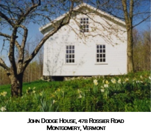
When the lower farm that was owned by John Green and Rosetta Stetson Green was sold to Peter Stone of Abercorn, Quebec in 1890, the sale price was $500. When Peter Stone sold to John Rodney Dodge in 1900, the sale price was $1,000.
What improvements to the property took place between 1890 and 1900 to justify a 100% increase in sale price over a short 10-year interval ? We think that the original house must have burned or was so small and in such bad shape that the price in 1890 was only $500. We believe that Peter Stone must have built the balloon-frame house that stands today. It is reasonable to think that the house would have been worth $500, thus the increase in value.
The attached ell
to the West which had the kitchen, shallow enclosed porch, bedroom in the attic, and a single-bay garage had collapsed by 1990. The Anderson Family straightened the house, replaced the rafters and metal roof, replaced all the windows and gave the house two coats of white paint. This is the John Dodge House.
In 1900 John Dodge acquired the two, combined, lower farms. He married Mary Elizabeth Gilmore Dodge, and raised two children - Dorcas Agnes Dodge and Paul John Dodge. Mary Elizabeth Gilmore Dodge died in 1921. John Dodge remarried Mary Ann "Mamie" Manosh of Montgomery. They had one child - daughter Theresa Dodge. John and "Mamie" continued to farm here until 1945 when they sold the farm to Kenneth Freer and moved to Main Street in Montgomery Center. Life was difficult for John Dodge and his family.
The next owner was Kenneth Freer, the recently retired postmaster of Richford, Vermont. Kenneth Freer maintained a permanent home in Richford as he cared for the old Dodge Farm. In 1954 Freer planted the small field leading towards the Moosewood ponds in white spruce. He also planted Cortland apple trees in the pasture above and behind the John Dodge House and in the High Meadow. 40 years later over 100 Cortland apple trees remained along with numerous yellow "pie" apple trees, several Hawthorn trres, one "Dalgo" crab apple tree, two "Reine des Rennettes" apple trees and countless wild apple trees Freer also kept some beef cattle. Kenneth Freer was a good steward of the property. We never met him but we appreciate his ownership very much. And we love the apples !
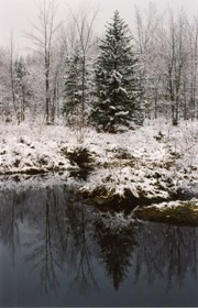
The next landowner was an investor from New York City who rarely visited the property, did no maintenance but neither developed nor subdivided the property. He sold the 200-year old, 24x40 feet barn which stood where the Red building
stands now. The barn components were taken to East Berkshire and sent to Westchester County, New York when trains still hauled freight through Franklin County. We regret the loss of both the barn and the train. The foundation stones for the barn that stood near the John Dodge House were organized into an attractive retaining wall behind the information kiosk. Master stone mason Charles Fichman of Montgomery and the talented Alfred Gendron of Richford built the wall in the late 1990's.
By 1978 when this writer first saw the property, the Rodney and Elizabeth Dodge House that had stood in the High Meadow was gone. The barn in the High Meadow was also gone. Next door neighbor Leland Snider thought that the house must have burned. The federal Rural Electrification Administration brought electricity to the Hazen's Notch Road in 1941. But there never was electricity beyond the Peter Stone house
at the lower farm. The Dodge family would have burned wood to heat the house from Fall through Spring; burned wood to cook year-round; and used oil lamps for light. It is no wonder many houses accidentally burned. That the barn is also gone along with the sugar house which stood on Flood Brook on the lower-most farm suggests that all the building material may have been removed. The field stone foundation remains although many stones have tumbled into the cellar hole. Part of the 24x40 feet foundation of the former barn remains. It is located 60 feet southwest (uphill) of the cellar hole.
The next landowner was an investor from Stowe, Vermont who occasionaly visited the property, did no maintenance but also did not develop the property. When he decided to sell the property he divided the old farm into two pieces. The lower parcel including several beaver ponds was 152 acres. The upper parcel including the High Meadow was 60 acres. We are grateful that this owner did not develop the property.
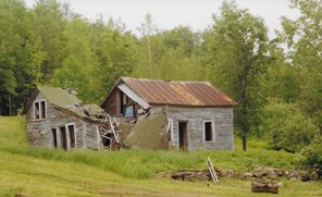
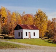
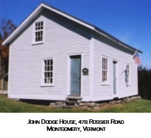
The Anderson Family (High Ponds Farm LLC) purchased the lower 151 acres in 1995 and began restoration of the pasture, orchard and the wood roads. The road to the High Meadow had become impassable. Marty Lumbra of Montgomery (grandson to Leland Snider), performed all of the landscaping and road restoration over a period of several years. Robert B. Anderson (no relation) and the late Jerry Mayhew, both of Montgomery, straightened the John Dodge House, replaced all of the windows, some clapboards, all of the roof rafters and attached a new metal roof and strengthened the floors.
The Andersons restored the orchards through clearing competing vegetation, pruning and fertilizing the trees. They created new trails, built footbridges and allowed limited public access for walking, snowshoeing and cross-country skiing. Next the Anderson Family purchased the 60-acre upper parcel that includes the High Meadow and began to restore the old road to the High Meadow and the meadow itself. A 20-acre parcel on "Rossier Hill" to the North of the Rossier Road was added in 2019.
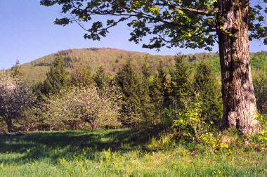
The former Dodge Farm is intact and remains essentially undeveloped. The High Meadow and the orchard/pasture at the entrance to the property have been restored and are managed as pollinator meadows. Beaver ponds remain in places that were wet pasture before 1950. Native plant and animal diversity have improved. Species and age-class diversity of forested areas has benefited overall forest health. Audubon Society guidelines for improving conditions for forest birds have been incorporated into the Stewardship management plan. The old town road through the property was discontinued by the Town of Montgomery at a meeting of the Selectboard in February 2004. It is now privately owned. Vehicle access is no longer allowed but the public is allowed to visit on foot. Please observe the rules mentioned here and posted at the property.
Hazen's Notch Conservation Trust |
The Hazen's Notch Conservation Trust was formed to conserve wildlife habitats, soil and water resources, undeveloped open space and natural areas, and non-motorized recreational trails. HNCT works with interested landowners to explore outdoor recreation opportunities compatible with their property and land management philosophy. A priority for the HNCT is to conserve parcels adjacent to existing conserved lands in order to expand protection of wildlife corridors and habitats.
Website: Hazen's Notch Conservation Trust, Inc.
References
Natural History of the High Ponds Farm, Montgomery, VermontSeptember 18, 2009
The Dodge Farm, 1995, Montgomery, Vermont
Dodge Farm, Montgomery, Vermont
Dodge Farm, Montgomery, Vermont
Bibliography